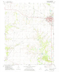
1974 Map of Nashville
USGS Topo · Published 1978About this map
The Nashville city center, marked by its Courthouse, Hospital, and Post Office, serves as the primary hub of this Southern Illinois landscape in the mid-1970s. The surrounding terrain of Plum Hill and Pilot Knob is defined by a dense network of country schools and family burial grounds, including the St Peters Cem and Locust Creek Cem. These small features, alongside the Trinity Sch, document a persistent rural community structure even as industrial activity expanded. The discovery of local resources is evident in the sprawling Cordes Oil Field and the Oil Field near the center of the sheet, while a northern Quarry suggests additional extractive work. Smaller hamlets like Addie, Kempside, and Cordes are linked by the Missouri - Illinois rail line, which cuts diagonally across the prairie between drainages like Lunte Creek and Locust Creek.
Find a feature on this map
55 named features on this map. Tap any name to fly to it.
Don’t see what you’re looking for? This feature index may not catch every label — zoom into the map to look around manually.
Map Details
Editions of this 1974 Nashville Map
2 editions found
Other maps of this area

1910 · Okawville
USGS Topo · 1:62,500

1914 · Coulterville
USGS Topo · 1:62,500

1917 · Coulterville
USGS Topo · 1:62,500

1924 · Pinckneyville
USGS Topo · 1:62,500

1926 · Pinckneyville
USGS Topo · 1:62,500

1931 · Hoyleton
USGS Topo · 1:48,000

1932 · Nashville
USGS Topo · 1:62,500

1936 · Nashville
USGS Topo · 1:62,500

1940 · Okawville
USGS Topo · 1:62,500

1958 · Belleville
USGS Topo · 1:250,000