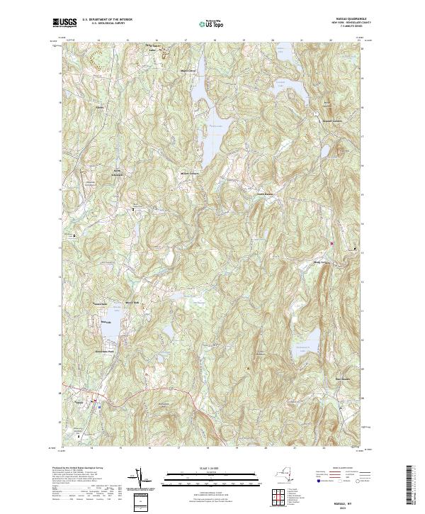
2023 Map of Nassau
USGS Topo · Published 2023About this map
Nassau and its surrounding villages sit within a landscape defined by an intricate network of glacial lakes and high ridges in Rensselaer County. The village centers of North Schodack, Millers Corners, and North Nassau are connected by winding country roads that navigate the upland terrain between Burden Lake and the larger Tackawasick Lake. The topography is marked by significant elevations such as Mashodack Hill and Curtis Mountain, which overlook a series of smaller ponds including Lyons Pond and Mud Pond.
Find a feature on this map
127 named features on this map. Tap any name to fly to it.
Don’t see what you’re looking for? This feature index may not catch every label — zoom into the map to look around manually.
Map Details
Editions of this 2023 Nassau Map
This is the sole edition of this map. No revisions or reprints were ever made.
Other maps of this area

1888 · Berlin
USGS Topo · 1:62,500

1888 · Pittsfield
USGS Topo · 1:62,500

1890 · Pittsfield
USGS Topo · 1:62,500

1890 · Berlin
USGS Topo · 1:62,500

1893 · Troy
USGS Topo · 1:62,500

1893 · Pittsfield
USGS Topo · 1:62,500

1894 · Berlin
USGS Topo · 1:62,500

1894 · Pittsfield
USGS Topo · 1:62,500

1895 · Troy
USGS Topo · 1:62,500

1897 · Pittsfield
USGS Topo · 1:62,500