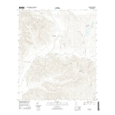
2014 Map of Natchez
USGS Topo · Published 2014About this map
Natchez and the surrounding Monroe County settlements sit within a landscape defined by the winding drainages of Big Flat Cr and Beaver Cr. This area of southern Alabama reflects a traditional rural layout where small communities like Scotland and Keith are connected by a network of winding roads such as Old Scotland Rd and River Ridge Rd. The presence of numerous family and community burial grounds, including Old Scotland Cem, Red Hills Cem, and Davidson Cem, provides significant value for genealogical research, anchoring historical family names to specific ridges and hollows. Notable water features like Natchez State Lake and the descriptive Stallworths Black Pond suggest the local importance of water resources in this timber and agricultural region. Significant crossings like Davis Bridge and Robinson Bridge indicate established transit points over the many creeks that dissect River Ridge.
Find a feature on this map
35 named features on this map. Tap any name to fly to it.
Don’t see what you’re looking for? This feature index may not catch every label — zoom into the map to look around manually.
Map Details
Editions of this 2014 Natchez Map
This is the sole edition of this map. No revisions or reprints were ever made.
Other maps of this area

1953 · Andalusia
USGS Topo · 1:250,000

1957 · Andalusia
USGS Topo · 1:250,000

1967 · Beatrice
USGS Topo · 1:24,000

1971 · Burnt Corn
USGS Topo · 1:24,000

1971 · Beatrice
USGS Topo · 1:24,000

1972 · Monroeville
USGS Topo · 1:24,000

1972 · Natchez
USGS Topo · 1:24,000

1972 · Franklin
USGS Topo · 1:24,000

1972 · Mexia
USGS Topo · 1:24,000

1973 · Hybart
USGS Topo · 1:24,000