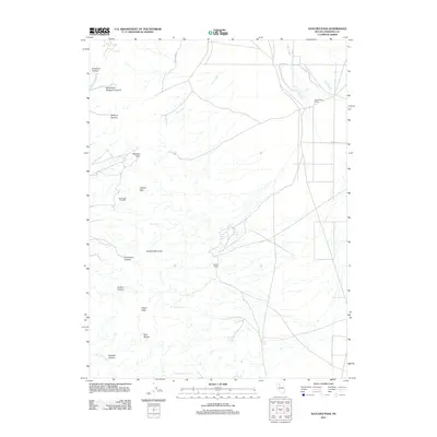
2011 Map of Natchez Pass
USGS Topo · Published 2011About this map
Rockhill Mountain and the southern reaches of the East Range dominate this interior portion of Pershing County, Nevada. The high-desert landscape is defined by its water sources and mining history, notably the Auld Lang Syne Mill located near Hayden Pass. Local habitation is concentrated at the Grass Valley Ranch and Hayden Ranch, connected by rural routes such as Jupiter Mine Rd.
Find a feature on this map
28 named features on this map. Tap any name to fly to it.
Don’t see what you’re looking for? This feature index may not catch every label — zoom into the map to look around manually.
Map Details
Editions of this 2011 Natchez Pass Map
This is the sole edition of this map. No revisions or reprints were ever made.
Other maps of this area

1932 · Sonoma Range
USGS Topo · 1:250,000

1939 · Sonoma Range
USGS Topo · 1:250,000

1955 · Winnemucca
USGS Topo · 1:250,000

1958 · Winnemucca
USGS Topo · 1:250,000

1958 · Winnemucca
USGS Topo · 1:62,500

1958 · Rose Creek
USGS Topo · 1:62,500

1961 · Leach Hot Springs
USGS Topo · 1:62,500

1961 · Dun Glen
USGS Topo · 1:62,500

1962 · Winnemucca
USGS Topo · 1:250,000
1982 · Rose Creek Mtn
USGS Topo · 1:24,000