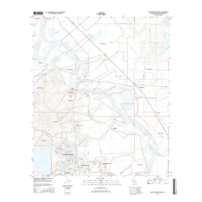
2015 Map of Natchitoches North
USGS Topo · Published 2015About this map
The Red River snakes through the center of this landscape, its winding course defining the geography of Natchitoches Parish. Overlooking a sharp bend in the river, the Grand Ecore Bluff provides a commanding elevation near the settlement of Grand Ecore. To the south, the city of Natchitoches serves as a center for education and history, anchored by the Northwestern State Univ of Louisiana and the Louisiana Technical College-Natchitoches Campus. The area is notably dense with burial sites for genealogists, including the American Cem, Catholic Cem, and Memory Lawn Cem. A complex network of waterways, such as Bayou Pierre, Bayou Couchinaha, and Bayou Ile Aux Vaches, crisscrosses the lowlands, reflecting the alluvial character of the Red River valley and its influence on local development and land use patterns.
Find a feature on this map
61 named features on this map. Tap any name to fly to it.
Don’t see what you’re looking for? This feature index may not catch every label — zoom into the map to look around manually.
Map Details
Editions of this 2015 Natchitoches North Map
This is the sole edition of this map. No revisions or reprints were ever made.
Other maps of this area

1935 · Hagewood
USGS Topo · 1:31,680

1937 · Campti NE
USGS Topo · 1:31,680

1937 · Bermuda
USGS Topo · 1:31,680

1937 · Campti SE
USGS Topo · 1:31,680

1937 · Campti NW
USGS Topo · 1:31,680

1937 · Montgomery
USGS Topo · 1:62,500

1937 · Campti SW
USGS Topo · 1:31,680

1942 · Montgomery
USGS Topo · 1:62,500

1943 · Provencal
USGS Topo · 1:62,500

1944 · Campti
USGS Topo · 1:62,500