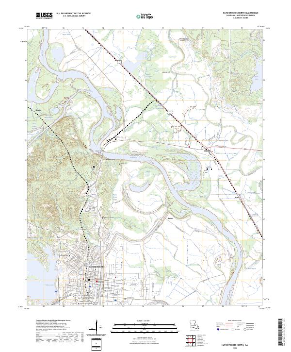
2024 Map of Natchitoches North
USGS Topo · Published 2024About this map
Natchitoches and the winding course of the Red River anchor this 2024 topographic survey, illustrating the complex relationship between the city and its surrounding bayou-laced wetlands. The map documents the northern expansion of the city, including prominent institutional campuses such as Northwestern State University of Louisiana and the Louisiana School for Math Science and the Arts. The historic core is represented by significant sites like the Natchitoches Parish Courthouse and the American Cem, alongside more contemporary neighborhood developments and the grid-patterned streets of the downtown area.
Find a feature on this map
139 named features on this map. Tap any name to fly to it.
Don’t see what you’re looking for? This feature index may not catch every label — zoom into the map to look around manually.
Map Details
Editions of this 2024 Natchitoches North Map
This is the sole edition of this map. No revisions or reprints were ever made.
Other maps of this area

1935 · Hagewood
USGS Topo · 1:31,680

1937 · Campti NE
USGS Topo · 1:31,680

1937 · Bermuda
USGS Topo · 1:31,680

1937 · Campti SE
USGS Topo · 1:31,680

1937 · Campti NW
USGS Topo · 1:31,680

1937 · Montgomery
USGS Topo · 1:62,500

1937 · Campti SW
USGS Topo · 1:31,680

1942 · Montgomery
USGS Topo · 1:62,500

1943 · Provencal
USGS Topo · 1:62,500

1944 · Campti
USGS Topo · 1:62,500