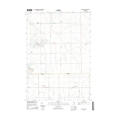
2014 Map of National City
USGS Topo · Published 2014About this map
National City and the small settlement of Mcivor anchor this landscape along the border of Iosco and Arenac counties. The terrain is defined by a complex network of agricultural and natural water management, featuring the E Br Au Gres River and numerous engineered waterways like the Sherrit Drain and Kelchner Drain. These channels underscore a long-standing history of land reclamation and drainage in Michigan's eastern lower peninsula. To the south, the Iosco and Arenac county line runs parallel to County Line Drain, while the eastern portion of the map is marked by the winding courses of Sand Cr and Saddler Cr. This 2014 survey captures a rural environment where local infrastructure, represented by roads like Whittemore Rd and Alabaster Rd, facilitates the movement between these small hubs and the surrounding river-fed valleys.
Find a feature on this map
48 named features on this map. Tap any name to fly to it.
Don’t see what you’re looking for? This feature index may not catch every label — zoom into the map to look around manually.
Map Details
Editions of this 2014 National City Map
This is the sole edition of this map. No revisions or reprints were ever made.
Other maps of this area

1954 · Tawas City
USGS Topo · 1:250,000

1958 · Tawas City
USGS Topo · 1:250,000

1959 · Tawas City
USGS Topo · 1:62,500

1966 · Point Lookout
USGS Topo · 1:24,000

1966 · Au Gres
USGS Topo · 1:24,000

1966 · Alabaster
USGS Topo · 1:24,000

1966 · National City
USGS Topo · 1:24,000

1968 · Whittemore
USGS Topo · 1:24,000
1968 · Omer
USGS Topo · 1:24,000

1968 · Hale SE
USGS Topo · 1:24,000