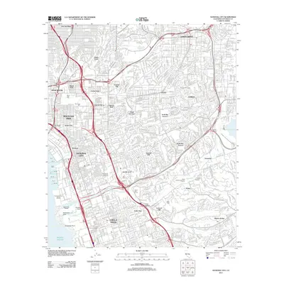
2012 Map of National City
USGS Topo · Published 2012About this map
National City and its surrounding suburban landscape appear here in high detail, illustrating a densely packed residential and industrial corridor along the Pacific Ocean coastline. The map records a complex network of neighborhoods including Stockton, Mountain View, and Emerald Hills, transitioning into the southern reach of Chula Vista. A significant concentration of large memorial parks and cemeteries, such as Holy Cross Cem, Mount Hope Cem, and Greenwood Cem, defines much of the northwestern terrain.
Find a feature on this map
51 named features on this map. Tap any name to fly to it.
Don’t see what you’re looking for? This feature index may not catch every label — zoom into the map to look around manually.
Map Details
Editions of this 2012 National City Map
This is the sole edition of this map. No revisions or reprints were ever made.
Other maps of this area

1893 · El Cajon
USGS Topo · 1:62,500

1901 · Elcajon
USGS Topo · 1:62,500

1903 · Cuyamaca
USGS Topo · 1:125,000

1903 · La Jolla
USGS Topo · 1:62,500

1903 · Elcajon
USGS Topo · 1:62,500

1904 · San Diego
USGS Topo · 1:62,500

1904 · Southern California Sheet No. 2
USGS Topo · 1:250,000

1930 · La Jolla
USGS Topo · 1:62,500

1930 · San Diego
USGS Topo · 1:62,500

1939 · El Cajon
USGS Topo · 1:62,500