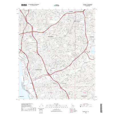
2018 Map of National City
USGS Topo · Published 2018About this map
National City and the surrounding South Bay region are characterized by a dense grid of residential neighborhoods and a significant concentration of historical cemeteries and memorial parks. Large sites such as Mount Hope Cem, Greenwood Cem, and the Cypress View Mausoleum occupy prominent positions in the landscape, providing essential touchpoints for genealogical research. The terrain is defined by the winding course of the Sweetwater River, which flows toward the San Diego Bay through the Sweetwater Marsh, a distinct natural area near Gunpowder Point.
Find a feature on this map
52 named features on this map. Tap any name to fly to it.
Don’t see what you’re looking for? This feature index may not catch every label — zoom into the map to look around manually.
Map Details
Editions of this 2018 National City Map
This is the sole edition of this map. No revisions or reprints were ever made.
Other maps of this area

1893 · El Cajon
USGS Topo · 1:62,500

1901 · Elcajon
USGS Topo · 1:62,500

1903 · Cuyamaca
USGS Topo · 1:125,000

1903 · La Jolla
USGS Topo · 1:62,500

1903 · Elcajon
USGS Topo · 1:62,500

1904 · San Diego
USGS Topo · 1:62,500

1904 · Southern California Sheet No. 2
USGS Topo · 1:250,000

1930 · La Jolla
USGS Topo · 1:62,500

1930 · San Diego
USGS Topo · 1:62,500

1939 · El Cajon
USGS Topo · 1:62,500