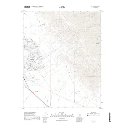
2018 Map of Natividad
USGS Topo · Published 2018About this map
Salinas expands toward the northeast in this 21st-century survey, where dense residential streets meet the rising slopes of the Gabilan Range. The map documents the transition from the organized grid of the city to the more complex topography of the foothills, notably around the community of Natividad and the steep drainage of Dunn Canyon. Water management is a defining characteristic of the local landscape, shown through the courses of Gabilan Cr, Natividad Cr, and Alisal Cr as they flow from the mountains toward the valley floor. Transportation corridors such as San Juan Grade Rd and Old Stage Rd trace historical routes through the area, while the Salinas Municipal Airport occupies a significant footprint on the southern edge of the developed city. This study captures the modern infrastructure required to balance urban growth with the natural seasonal drainage systems of the Alisal Slough.
Find a feature on this map
94 named features on this map. Tap any name to fly to it.
Don’t see what you’re looking for? This feature index may not catch every label — zoom into the map to look around manually.
Map Details
Editions of this 2018 Natividad Map
This is the sole edition of this map. No revisions or reprints were ever made.
Other maps of this area

1910 · Gonzales
USGS Topo · 1:31,680

1910 · Salinas
USGS Topo · 1:31,680

1912 · Salinas
USGS Topo · 1:62,500

1915 · San Juan Bautista
USGS Topo · 1:48,000

1917 · San Juan Bautista
USGS Topo · 1:62,500

1919 · Hollister
USGS Topo · 1:48,000

1921 · Gonzales
USGS Topo · 1:62,500

1921 · Hollister
USGS Topo · 1:62,500

1923 · Hollister
USGS Topo · 1:62,500

1939 · San Juan Bautista
USGS Topo · 1:62,500