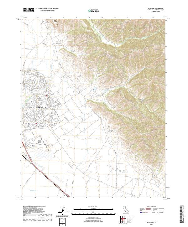
2021 Map of Natividad
USGS Topo · Published 2021About this map
The Gabilan Range dominates the eastern horizon of this Monterey County landscape, where the sharp transition from steep, folding canyons like Dunn Canyon meets the flat, fertile floor of the Salinas Valley. This modern topographic view illustrates the northern expansion of Salinas, where suburban street grids such as those along Constitution Blvd and Nantucket Blvd press directly against the historic agricultural and ranching lands of the Natividad area. The drainage patterns of Gabilan Cr and Natividad Cr define the local topography, feeding into the lower Alisal Slough to the south.
Find a feature on this map
96 named features on this map. Tap any name to fly to it.
Don’t see what you’re looking for? This feature index may not catch every label — zoom into the map to look around manually.
Map Details
Editions of this 2021 Natividad Map
This is the sole edition of this map. No revisions or reprints were ever made.
Other maps of this area

1910 · Gonzales
USGS Topo · 1:31,680

1910 · Salinas
USGS Topo · 1:31,680

1912 · Salinas
USGS Topo · 1:62,500

1915 · San Juan Bautista
USGS Topo · 1:48,000

1917 · San Juan Bautista
USGS Topo · 1:62,500

1919 · Hollister
USGS Topo · 1:48,000

1921 · Gonzales
USGS Topo · 1:62,500

1921 · Hollister
USGS Topo · 1:62,500

1923 · Hollister
USGS Topo · 1:62,500

1939 · San Juan Bautista
USGS Topo · 1:62,500