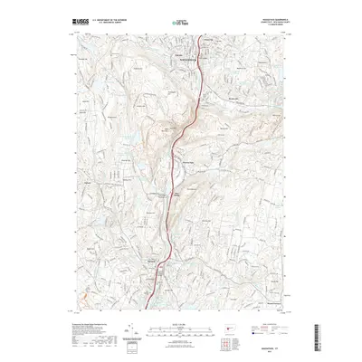
2021 Map of Naugatuck
USGS Topo · Published 2021About this map
Naugatuck and the surrounding valley communities of Union City, Beacon Falls, and Seymour are defined by their position along the Naugatuck River in this 2021 study. The landscape is characterized by a series of prominent elevations, including High Rock, Rock Rimmon, and Hunters Mtn, which frame the industrial and residential corridors of the valley. This modern survey illustrates the persistent importance of the river corridor, now featuring the Seymour-Naugatuck River Greenway Trl alongside the long-established Salem Bridge rail crossing.
Find a feature on this map
92 named features on this map. Tap any name to fly to it.
Don’t see what you’re looking for? This feature index may not catch every label — zoom into the map to look around manually.
Map Details
Editions of this 2021 Naugatuck Map
This is the sole edition of this map. No revisions or reprints were ever made.
Other maps of this area

1889 · Derby
USGS Topo · 1:62,500

1891 · Derby
USGS Topo · 1:62,500

1892 · New Haven
USGS Topo · 1:62,500

1892 · Meriden
USGS Topo · 1:62,500

1893 · Waterbury
USGS Topo · 1:62,500

1893 · Meriden
USGS Topo · 1:62,500

1893 · Derby
USGS Topo · 1:62,500

1904 · Waterbury
USGS Topo · 1:62,500

1904 · Litchfield
USGS Topo · 1:125,000

1906 · Farmington
USGS Topo · 1:125,000