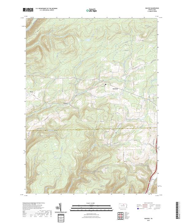
2023 Map of Nauvoo
USGS Topo · Published 2023About this map
Nauvoo and Hartsfield sit at the center of this rural Pennsylvania landscape, where the topography of the northern Alleghenies dictates the settlement patterns and road networks. The terrain is defined by prominent elevations such as Hickory Ridge and deep incisions like Longsdorf Hollow and Bear Hollow. Local life and history are anchored at the Salem Lutheran Cem, while the county line between Tioga Co and Lycoming Co bisects the southern reaches of the map. Numerous small watercourses, including Zimmerman Creek, Little Fall Creek, and Opossum Run, drain the high ground. The network of secondary routes like Nauvoo Rd and Landrus Rd connect isolated hamlets like Plank and Sugar Hill, tracing the winding valleys and ridges that have shaped this community for generations.
Find a feature on this map
67 named features on this map. Tap any name to fly to it.
Don’t see what you’re looking for? This feature index may not catch every label — zoom into the map to look around manually.
Map Details
Editions of this 2023 Nauvoo Map
This is the sole edition of this map. No revisions or reprints were ever made.
Other maps of this area

1921 · Trout Run
USGS Topo · 1:62,500

1923 · Trout Run
USGS Topo · 1:62,500

1925 · Blossburg
USGS Topo · 1:62,500

1927 · Blossburg
USGS Topo · 1:62,500

1937 · Waterville
USGS Topo · 1:48,000

1943 · Waterville
USGS Topo · 1:62,500

1944 · Blossburg
USGS Topo · 1:62,500

1944 · Trout Run
USGS Topo · 1:62,500

1946 · Antrim
USGS Topo · 1:62,500

1946 · Antrim
USGS Topo · 1:24,000