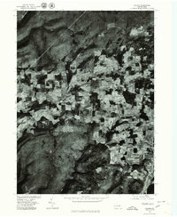
1977 Map of Nauvoo
USGS Topo · Published 1979About this map
Nauvoo serves as the central hub of this 1977 orthophotoquad, which uses rectified aerial imagery to reveal the agricultural and forest patterns of the Tioga County landscape. The high-contrast imagery highlights the sharp division between the cleared farm fields of Hartfield and the dense wooded ridges that characterize this part of Pennsylvania. By utilizing photoimagery instead of traditional topographic line work, the map provides a realistic look at the rural road network and individual structures as they existed in the late 1970s. The settlement at Plank and the surrounding properties show the small-scale land use patterns typical of the region before modern development or large-scale changes to the forest cover. This photographic record, produced in cooperation with the Soil Conservation Service, captures the exact state of field drainage and woodland boundaries on the day the flight was taken.
Find a feature on this map
3 named features on this map. Tap any name to fly to it.
Don’t see what you’re looking for? This feature index may not catch every label — zoom into the map to look around manually.
Map Details
Editions of this 1977 Nauvoo Map
This is the sole edition of this map. No revisions or reprints were ever made.
Other maps of this area

1921 · Trout Run
USGS Topo · 1:62,500

1923 · Trout Run
USGS Topo · 1:62,500

1925 · Blossburg
USGS Topo · 1:62,500

1927 · Blossburg
USGS Topo · 1:62,500

1937 · Waterville
USGS Topo · 1:48,000

1943 · Waterville
USGS Topo · 1:62,500

1944 · Blossburg
USGS Topo · 1:62,500

1944 · Trout Run
USGS Topo · 1:62,500

1946 · Antrim
USGS Topo · 1:62,500

1946 · Antrim
USGS Topo · 1:24,000