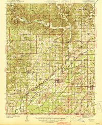
1944 Map of Naylor
USGS Topo · Published 1974About this map
The Little Black River bisects this landscape, separating the wooded hills of the Ozark foothills from the alluvial lowlands of the Mississippi embayment. In the 1940s, this region was defined by a transition from the elevated terrain of Flatwoods to the ditch-drained agricultural plains near Neelyville. The rail network was a central pillar of local life, with the St Louis-San Francisco RR and Missouri Pacific RR facilitating timber and crop transport through settlements like Naylor and Gamburg.
Find a feature on this map
93 named features on this map. Tap any name to fly to it.
Don’t see what you’re looking for? This feature index may not catch every label — zoom into the map to look around manually.
Map Details
Editions of this 1944 Naylor Map
2 editions found

Other maps of this area

1934 · Williamsville
USGS Topo · 1:48,000

1935 · Poplar Bluff
USGS Topo · 1:62,500

1935 · Acorn
USGS Topo · 1:62,500

1935 · Rector
USGS Topo · 1:62,500

1935 · Knobel
USGS Topo · 1:62,500

1935 · Reyno
USGS Topo · 1:62,500

1935 · Harviell
USGS Topo · 1:62,500

1939 · Poplar Bluff
USGS Topo · 1:62,500

1939 · Doniphan
USGS Topo · 1:62,500

1940 · Williamsville
USGS Topo · 1:62,500