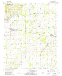
1979 Map of Naylor
USGS Topo · Published 1980About this map
The Little Black River winds through the northwestern corner of this 1970s landscape, marking the transition from the rolling elevations of Washington and Varner into the drainage-intensive lowlands of the southeast. The town of Naylor serves as a primary hub, situated near the Masonic Cem and Barfield Cem, while the Missouri Pacific line cuts a straight path across the terrain toward Neelyville. A complex network of ditches and sloughs, including Guines Slough and Cypress Slough, defines the local water management, reflecting the area's agricultural foundations.
Find a feature on this map
45 named features on this map. Tap any name to fly to it.
Don’t see what you’re looking for? This feature index may not catch every label — zoom into the map to look around manually.
Map Details
Editions of this 1979 Naylor Map
This is the sole edition of this map. No revisions or reprints were ever made.
Other maps of this area

1935 · Acorn
USGS Topo · 1:62,500

1935 · Rector
USGS Topo · 1:62,500

1935 · Knobel
USGS Topo · 1:62,500

1935 · Harviell
USGS Topo · 1:62,500

1940 · Naylor
USGS Topo · 1:62,500

1941 · Knobel
USGS Topo · 1:62,500

1944 · Naylor
USGS Topo · 1:62,500

1957 · Poplar Bluff
USGS Topo · 1:250,000

1958 · Rector
USGS Topo · 1:62,500

1959 · Poplar Bluff
USGS Topo · 1:250,000