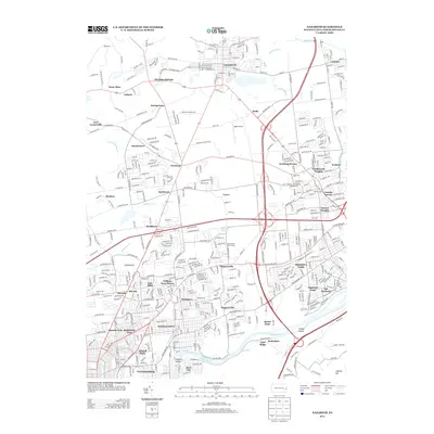
2013 Map of Nazareth
USGS Topo · Published 2013About this map
Nazareth serves as the focal point of this 2013 survey, surrounded by a cluster of established villages and burgeoning residential developments in Northampton County. The landscape is a complex mix of historic crossroads and modern infrastructure, where the legacy of the Moravian settlement at Christian Springs meets the industrial corridors along the Lehigh River. Significant water features like Schoeneck Creek and Monocacy Creek wind through the terrain, while the Lehigh Coal and Navigation Canal remains a prominent landmark of the region's transport history. Modern growth is evident in neighborhoods like Northwood Heights and Newburg Homes, yet the map still preserves the names of smaller, long-standing hamlets such as Hecktown, Farmersville, and Butztown. The presence of Bugs Airport and the Norfolk Southern railroad line highlights the continuing importance of this area as a transportation hub within the Lehigh Valley.
Find a feature on this map
442 named features on this map. Tap any name to fly to it.
Don’t see what you’re looking for? This feature index may not catch every label — zoom into the map to look around manually.
Map Details
Editions of this 2013 Nazareth Map
This is the sole edition of this map. No revisions or reprints were ever made.
Other maps of this area

1890 · Easton
USGS Topo · 1:62,500

1891 · Easton
USGS Topo · 1:62,500

1891 · Delaware Water Gap
USGS Topo · 1:62,500

1893 · Delaware Water Gap
USGS Topo · 1:62,500

1894 · Allentown
USGS Topo · 1:62,500

1914 · Wind Gap
USGS Topo · 1:62,500

1916 · Wind Gap
USGS Topo · 1:62,500

1932 · Easton
USGS Topo · 1:62,500

1936 · Delaware Water Gap
USGS Topo · 1:48,000

1939 · Allentown
USGS Topo · 1:62,500