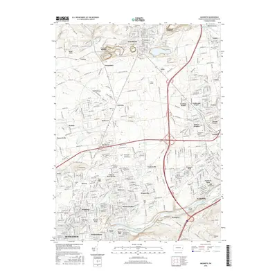
2016 Map of Nazareth
USGS Topo · Published 2016About this map
The borough of Nazareth anchors this portion of Northampton County, displaying a landscape where historic Moravian roots meet modern suburban expansion. Religious and genealogical history is prominent through sites such as the Moravian Cem, Holy Family Cem, and the Saint Johns Cem. To the south, the industrial and transport corridor follows the Lehigh River, where the Lehigh Coal and Navigation Canal remains a visible landmark of Pennsylvania’s anthracite-moving past. The area between Nazareth and Bethlehem is a dense network of named communities, from Hecktown and Smoketown to more recent developments like Northwood Heights and William Penn Manor. Significant landmarks including Bugs Airport and the Northampton County Area Community College illustrate the mid-20th-century transition from agrarian fields to educational and aviation infrastructure.
Find a feature on this map
411 named features on this map. Tap any name to fly to it.
Don’t see what you’re looking for? This feature index may not catch every label — zoom into the map to look around manually.
Map Details
Editions of this 2016 Nazareth Map
This is the sole edition of this map. No revisions or reprints were ever made.
Other maps of this area

1890 · Easton
USGS Topo · 1:62,500

1891 · Easton
USGS Topo · 1:62,500

1891 · Delaware Water Gap
USGS Topo · 1:62,500

1893 · Delaware Water Gap
USGS Topo · 1:62,500

1894 · Allentown
USGS Topo · 1:62,500

1914 · Wind Gap
USGS Topo · 1:62,500

1916 · Wind Gap
USGS Topo · 1:62,500

1932 · Easton
USGS Topo · 1:62,500

1936 · Delaware Water Gap
USGS Topo · 1:48,000

1939 · Allentown
USGS Topo · 1:62,500