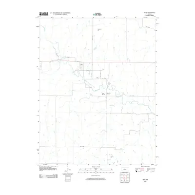
2009 Map of Neal
USGS Topo · Published 2009About this map
Neal serves as the central settlement in this eastern Kansas landscape, situated near the intersection of Quincy St and several township roads. The topography is defined by the meandering course of Walnut Creek, which draws together several smaller tributaries including Homer Creek, Kuntz Branch, and Tar Creek. To the south, the terrain transitions into the Fancy Oil Field, indicating the importance of energy extraction to the local economy alongside the rural agricultural patterns established by the township grid.
Find a feature on this map
31 named features on this map. Tap any name to fly to it.
Don’t see what you’re looking for? This feature index may not catch every label — zoom into the map to look around manually.
Map Details
Editions of this 2009 Neal Map
This is the sole edition of this map. No revisions or reprints were ever made.
Other maps of this area

1885 · Eureka
USGS Topo · 1:125,000

1886 · Fredonia
USGS Topo · 1:125,000

1888 · Eureka
USGS Topo · 1:125,000

1894 · Fredonia
USGS Topo · 1:125,000

1894 · Eureka
USGS Topo · 1:125,000

1938 · Fredonia
USGS Topo · 1:62,500

1939 · Fredonia
USGS Topo · 1:48,000

1939 · Severy
USGS Topo · 1:62,500

1941 · Severy
USGS Topo · 1:62,500

1942 · Fredonia
USGS Topo · 1:62,500