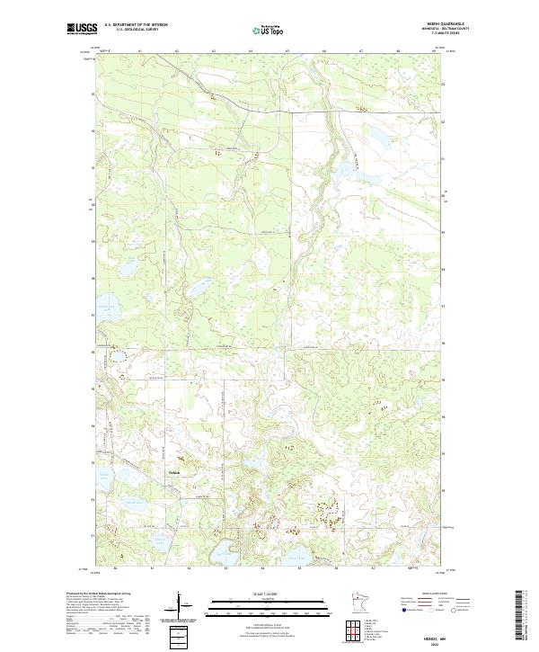
2022 Map of Nebish
USGS Topo · Published 2022About this map
Nebish serves as the central settlement in this northern Minnesota landscape, surrounded by an intricate system of small lakes and creek drainages. The area is defined by its water-rich geography, featuring larger bodies like Hagali Lake and Dark Lake alongside smaller, uniquely named basins such as Gibibwisher Lake, Smyth Lake, and Wendling Lake. Much of the terrain is drained by the winding course of Hay Cr, which meanders through the township boundaries. A dense network of local routes, including Co Rd 32 and Jack Lake Rd NE, provides access to the scattered homesteads and seasonal properties that dot the wooded interior. The land is heavily partitioned by reservation and township lines, seen in the boundaries of t150n r33w and t151n r32w, reflecting the complex historical land management of Beltrami County. This topography reveals a quiet, interior lake country where the local road names, like Cozzi Farm Rd NE, hint at the area's agricultural and rural roots.
Find a feature on this map
43 named features on this map. Tap any name to fly to it.
Don’t see what you’re looking for? This feature index may not catch every label — zoom into the map to look around manually.
Map Details
Editions of this 2022 Nebish Map
This is the sole edition of this map. No revisions or reprints were ever made.
Other maps of this area

1919 · Quiring
USGS Topo · 1:62,500

1920 · Buena Vista
USGS Topo · 1:62,500

1954 · Bemidji
USGS Topo · 1:250,000

1957 · Bemidji
USGS Topo · 1:250,000

1958 · Bemidji
USGS Topo · 1:250,000

1972 · Redby
USGS Topo · 1:24,000

1972 · White Fish Lake
USGS Topo · 1:24,000
1972 · O'Brien Lookout Tower
USGS Topo · 1:24,000
1972 · Nebish
USGS Topo · 1:24,000
1972 · Tenstrike
USGS Topo · 1:24,000