
2014 Map of Nebo
USGS Topo · Published 2014About this map
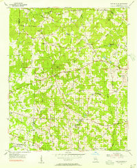
Sweetwater Creek and its many tributaries, including Gothards Creek and Lick Log Creek, define the landscape of the Paulding and Douglas County border. This 2014 survey captures a period of significant suburban expansion, evidenced by the dense network of residential developments such as Honeysuckle Plantation, Campground School Estates, and Bakers Bridge Estates. While the area is increasingly residential, numerous historical anchors remain, including the Star of Bethlehem Cemetery and New Harmony Cemetery. Local aviation history is represented by Pinewood Airport near Oberlochen, while the topography is punctuated by Cedar Mountain in the south. The proximity to Hiram and the growth of Nebo reflect the modernization of the corridor along the Hiram Douglasville Highway and Villa Rica Highway.
Find a feature on this map
119 named features on this map. Tap any name to fly to it.
Don’t see what you’re looking for? This feature index may not catch every label — zoom into the map to look around manually.
Map Details
Editions of this 2014 Nebo Map
This is the sole edition of this map. No revisions or reprints were ever made.
Other maps of this area

1891 · Marietta
USGS Topo · 1:125,000

1895 · Marietta
USGS Topo · 1:125,000

1897 · Marietta
USGS Topo · 1:125,000

1901 · Marietta
USGS Topo · 1:125,000

1953 · Atlanta
USGS Topo · 1:250,000

1954 · Campbellton
USGS Topo · 1:24,000
1954 · Lost Mountain
USGS Topo · 1:24,000

1954 · Austell
USGS Topo · 1:24,000

1957 · Atlanta
USGS Topo · 1:250,000

1958 · Atlanta
USGS Topo · 1:250,000