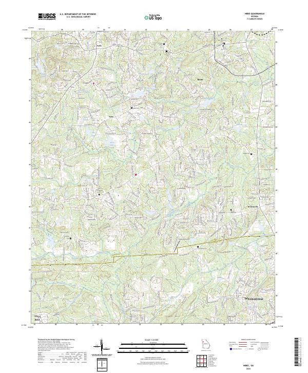
2024 Map of Nebo
USGS Topo · Published 2024About this map
The boundary between Paulding Co and Douglas Co anchors this modern topographic survey, capturing a landscape defined by small water bodies and evolving residential patterns. Numerous family and community landmarks are visible, including the New Harmony Cem and Cochran Ridge Cem in the north, while Pinewood Airport serves as a distinct aviation landmark in the central region. The area's hydrology is heavily modified by small impoundments such as Lake Jane, Hatcher Lake, and Lake Douglas, reflecting the suburban development surrounding the larger centers of Douglasville and Hiram.
Find a feature on this map
99 named features on this map. Tap any name to fly to it.
Don’t see what you’re looking for? This feature index may not catch every label — zoom into the map to look around manually.
Map Details
Editions of this 2024 Nebo Map
This is the sole edition of this map. No revisions or reprints were ever made.
Other maps of this area

1891 · Marietta
USGS Topo · 1:125,000

1895 · Marietta
USGS Topo · 1:125,000

1897 · Marietta
USGS Topo · 1:125,000

1901 · Marietta
USGS Topo · 1:125,000

1953 · Atlanta
USGS Topo · 1:250,000

1954 · Campbellton
USGS Topo · 1:24,000
1954 · Lost Mountain
USGS Topo · 1:24,000

1954 · Austell
USGS Topo · 1:24,000

1957 · Atlanta
USGS Topo · 1:250,000

1958 · Atlanta
USGS Topo · 1:250,000