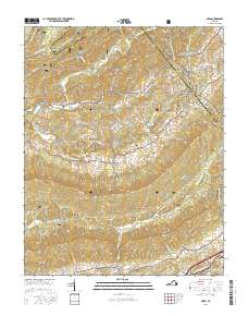
2016 Map of Nebo
USGS Topo · Published 2016About this map
The Appalachian National Scenic Trail winds through the heart of the Jefferson National Forest, traversing high ridges like Walker Mtn and Brushy Mtn. This 2016 survey captures the rugged corridor where the borders of Smyth, Wythe, Bland, and Tazewell counties converge. The drainage of the North Fork Holston River defines the central valley, where small rural settlements such as Nebo and the historic Groseclose Store are situated. Family history is well-preserved across this landscape through numerous burial sites, including the Snavely Cem, Cregger Cem, and Goodman Cem. In the southern portion of the map, the Middle Fork Holston River passes near the community of Atkins, marking a shift in the local topography near the intersection of Davis Valley Rd and Phipps Rd.
Find a feature on this map
77 named features on this map. Tap any name to fly to it.
Don’t see what you’re looking for? This feature index may not catch every label — zoom into the map to look around manually.
Map Details
Editions of this 2016 Nebo Map
This is the sole edition of this map. No revisions or reprints were ever made.
Other maps of this area

1887 · Pocahontas
USGS Topo · 1:125,000

1889 · Wytheville
USGS Topo · 1:125,000

1891 · Tazewell
USGS Topo · 1:125,000

1891 · Pocahontas
USGS Topo · 1:125,000

1891 · Abingdon
USGS Topo · 1:125,000

1892 · Wytheville
USGS Topo · 1:125,000

1894 · Pocahontas
USGS Topo · 1:125,000

1894 · Abingdon
USGS Topo · 1:125,000

1895 · Tazewell
USGS Topo · 1:125,000

1895 · Pocahontas
USGS Topo · 1:125,000