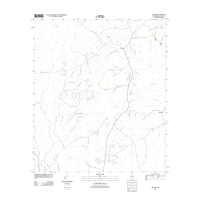
2012 Map of Necaise
USGS Topo · Published 2012About this map
Necaise and the surrounding rural landscapes of Hancock County are defined by a complex network of waterways and a long history of family settlements. Local infrastructure is anchored by landmarks like the Necaise Lookout Tower and Sellers Lookout Tower, while the Mint Julep Airpark indicates more modern aviation activity amidst the timber and farm lands. The area is heavily intersected by creek systems including Hickory Creek, White Cypress Creek, and Bayou Bacon, which have historically shaped the roads and property lines of the region.
Find a feature on this map
101 named features on this map. Tap any name to fly to it.
Don’t see what you’re looking for? This feature index may not catch every label — zoom into the map to look around manually.
Map Details
Editions of this 2012 Necaise Map
This is the sole edition of this map. No revisions or reprints were ever made.
Other maps of this area

1914 · Nicholson
USGS Topo · 1:62,500

1921 · Nicholson
USGS Topo · 1:62,500

1953 · Mobile
USGS Topo · 1:250,000

1955 · Savannah
USGS Topo · 1:62,500

1956 · Vidalia
USGS Topo · 1:24,000

1957 · Mobile
USGS Topo · 1:250,000

1957 · Dead Tiger Creek
USGS Topo · 1:24,000

1958 · Picayune
USGS Topo · 1:62,500
1959 · Kiln
USGS Topo · 1:24,000
1959 · Nicholson
USGS Topo · 1:62,500