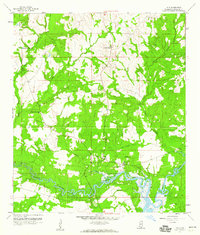
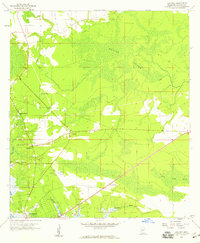
1959 Map of Kiln
USGS Topo · Published 1960About this map
Kiln and the surrounding piney lowlands of Hancock County are defined by a complex network of waterways feeding into the Jourdan River. This late-1950s survey documents a landscape of small rural settlements and scattered houses, where life centered around local congregations like Lady of the Pines Ch and Annunciation Ch. To the east, the settlement of Fenton sits near the winding course of Rotten Bayou, while Maltini occupies a bend in the river further downstream. The prominence of the Lookout Tower near the center of the quadrangle suggests the importance of timber and forest management in this era. For those tracing regional history, the map provides exact locations for the Kiln Sch and several remote burial grounds, including the Little Rotten Bayou Cem and Bayou Coco Cem, situated along the marshy reaches of the coastal interior.
Find a feature on this map
21 named features on this map. Tap any name to fly to it.
Don’t see what you’re looking for? This feature index may not catch every label — zoom into the map to look around manually.
Map Details
Editions of this 1959 Kiln Map
4 editions found
Other maps of this area

1914 · Nicholson
USGS Topo · 1:62,500

1921 · Nicholson
USGS Topo · 1:62,500

1953 · Mobile
USGS Topo · 1:250,000

1955 · Savannah
USGS Topo · 1:62,500

1956 · Bay St. Louis
USGS Topo · 1:24,000

1956 · Vidalia
USGS Topo · 1:24,000

1956 · Waveland
USGS Topo · 1:24,000

1957 · Mobile
USGS Topo · 1:250,000

1957 · Dead Tiger Creek
USGS Topo · 1:24,000
1958 · Logtown
USGS Topo · 1:24,000