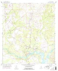
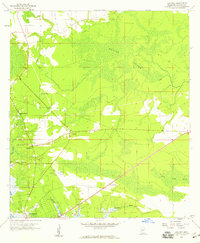
1959 Map of Kiln
USGS Topo · Published 1978About this map
The winding course of the Jourdan River and its complex network of bayous define the landscape around Kiln during the late 1950s and mid-1970s. This survey, updated with 1970s revisions, illustrates a community deeply rooted in its geography, with many spiritual and social centers such as Annunciation Ch and St Edwards Ch situated near the waterways. The emergence of the Stennis International Airport at the southern edge of the map indicates the region's mid-century shift toward aviation and modernization, contrasting with the established rural character of nearby Fenton. Genealogists may find particular value in the documentation of local burial sites, including the Bayou Coco Cem and the Little Rotten Bayou Cem, which serve as quiet markers of the families who settled along the banks of Bayou La Terre and Rotten Bayou.
Find a feature on this map
24 named features on this map. Tap any name to fly to it.
Don’t see what you’re looking for? This feature index may not catch every label — zoom into the map to look around manually.
Map Details
Editions of this 1959 Kiln Map
4 editions found
Other maps of this area

1914 · Nicholson
USGS Topo · 1:62,500

1921 · Nicholson
USGS Topo · 1:62,500

1953 · Mobile
USGS Topo · 1:250,000

1955 · Savannah
USGS Topo · 1:62,500

1956 · Bay St. Louis
USGS Topo · 1:24,000

1956 · Vidalia
USGS Topo · 1:24,000

1956 · Waveland
USGS Topo · 1:24,000

1957 · Mobile
USGS Topo · 1:250,000

1957 · Dead Tiger Creek
USGS Topo · 1:24,000
1958 · Logtown
USGS Topo · 1:24,000