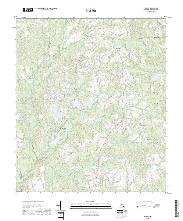
2024 Map of Necaise
USGS Topo · Published 2024About this map
Necaise and its surrounding rural community in Hancock County are defined by a complex network of coastal plain waterways and family-named roads. This modern survey illustrates the persistent importance of generational landholdings, with numerous local thoroughfares like Oris Ladner Rd, Wendell Ladner Rd, and Caesar Necaise Rd reflecting the heritage of the region. The landscape is dominated by the winding paths of White Cypress Creek and Bayou Bacon, which drain the low-lying terrain. While much of the area remains wooded or agricultural, the presence of the Mint Julep Airpark and Necaise Crossing Cem points to the diverse uses of the land, from modern aviation to quiet local history. The map provides a clear look at the drainage patterns of Orphan Creek and Bayou La Terre, which characterize the interior of the county away from the Gulf coast.
Find a feature on this map
81 named features on this map. Tap any name to fly to it.
Don’t see what you’re looking for? This feature index may not catch every label — zoom into the map to look around manually.
Map Details
Editions of this 2024 Necaise Map
This is the sole edition of this map. No revisions or reprints were ever made.
Other maps of this area

1914 · Nicholson
USGS Topo · 1:62,500

1921 · Nicholson
USGS Topo · 1:62,500

1953 · Mobile
USGS Topo · 1:250,000

1955 · Savannah
USGS Topo · 1:62,500

1956 · Vidalia
USGS Topo · 1:24,000

1957 · Mobile
USGS Topo · 1:250,000

1957 · Dead Tiger Creek
USGS Topo · 1:24,000

1958 · Picayune
USGS Topo · 1:62,500
1959 · Kiln
USGS Topo · 1:24,000
1959 · Nicholson
USGS Topo · 1:62,500