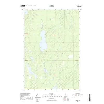
2019 Map of Ned Lake
USGS Topo · Published 2019About this map
Ned Lake and its surrounding wetlands form the center of this remote Northwoods landscape on the boundary of Baraga and Iron counties. The terrain is defined by a dense network of hydrologic features, including the Tioga River in the northeast and the E Br Net River in the northwest. Local history is etched into the landscape through timber-era infrastructure such as The B Grade and The Grade, representing former rail corridors that once served the region's logging industry. Numerous smaller water bodies like Shank Lake, Long Lake, and Bone Lake are connected by seasonal streams such as Ned Lake Cr and La Fournier Cr. Notable landforms include Flanigan Slough and the Camp Ten Cr drainage, illustrating the complex drainage patterns of this Upper Peninsula wilderness. Primitive roads like Tracy Lake Rd and Shank Lake Rd provide the primary access through these wooded townships.
Find a feature on this map
28 named features on this map. Tap any name to fly to it.
Don’t see what you’re looking for? This feature index may not catch every label — zoom into the map to look around manually.
Map Details
Editions of this 2019 Ned Lake Map
This is the sole edition of this map. No revisions or reprints were ever made.
Other maps of this area

1895 · Ned Lake
USGS Topo · 1:62,500

1899 · Witbeck
USGS Topo · 1:62,500

1955 · Ned Lake
USGS Topo · 1:62,500

1955 · Herman
USGS Topo · 1:62,500

1955 · Witch Lake
USGS Topo · 1:62,500

1956 · Three Lakes
USGS Topo · 1:24,000

1956 · Michigamme
USGS Topo · 1:62,500

1958 · Iron River
USGS Topo · 1:250,000

1960 · Iron River
USGS Topo · 1:250,000

1961 · Iron River
USGS Topo · 1:250,000
Featured Places
- Covington Township, MI
- Spurr Township, MI
- Crystal Falls Township, MI
- Hematite Township, MI
- Baraga County, MI