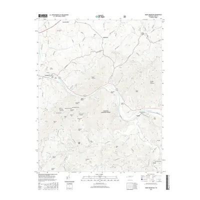
2016 Map of Neddy Mountain
USGS Topo · Published 2016About this map
The French Broad River carves a deep path through the heart of the Cherokee National Forest in this topographic survey, illustrating the rugged geography of Cocke County. The map details a landscape where river-bottom settlements like Del Rio and Bridgeport contrast with the high elevations of Neddy Mountain and the Meadow Creek Mountains. Along the many mountain drainages, such as Gulf Fork Big Cr, name-rich hollows like Iron Mine Hollow and Mud Tunnel Hollow reveal a history of local industry and settlement. Local genealogists will find several family burying grounds, including Faubion Cem near Baltimore and Kilgore Cem to the east. Of particular interest is the location of Click Mill, a remnant of the area's milling past situated along the southern creeks.
Find a feature on this map
114 named features on this map. Tap any name to fly to it.
Don’t see what you’re looking for? This feature index may not catch every label — zoom into the map to look around manually.
Map Details
Editions of this 2016 Neddy Mountain Map
This is the sole edition of this map. No revisions or reprints were ever made.
Other maps of this area

1883 · Morristown
USGS Topo · 1:125,000

1892 · Greeneville
USGS Topo · 1:125,000

1893 · Mt Guyot
USGS Topo · 1:125,000

1893 · Morristown
USGS Topo · 1:125,000

1894 · Asheville
USGS Topo · 1:125,000

1895 · Morristown
USGS Topo · 1:125,000

1896 · Greeneville
USGS Topo · 1:125,000

1901 · Asheville
USGS Topo · 1:125,000

1904 · Greeneville
USGS Topo · 1:125,000

1912 · Mt Guyot
USGS Topo · 1:125,000