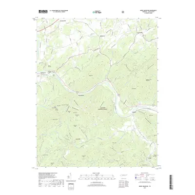
2019 Map of Neddy Mountain
USGS Topo · Published 2019About this map
The French Broad River carves a winding path through this corner of Cocke County, serving as the primary geographic corridor between Neddy Mtn and the Meadow Creek Mountains. This 2019 survey documents a landscape where traditional Appalachian settlements like Del Rio and Parrottsville persist alongside the protected expanse of the Cherokee National Forest. The topography is defined by high ridges and narrow hollows, such as Iron Mine Hollow and Summer House Hollow, which historically dictated the placement of roads and homesteads. Local history is anchored by family-named landmarks and infrastructure, including the James T Huff Bridge and several burial grounds like Faubion Cem and McNabb Cem. The map provides a detailed view of the transition from the river valley's agricultural pockets to the steep, wooded elevations of Beetree Knob and Chestnut Ridge, showing how modern road networks like HWY 321 now navigate the same terrain that once centered on local hubs like Click Mill.
Find a feature on this map
122 named features on this map. Tap any name to fly to it.
Don’t see what you’re looking for? This feature index may not catch every label — zoom into the map to look around manually.
Map Details
Editions of this 2019 Neddy Mountain Map
This is the sole edition of this map. No revisions or reprints were ever made.
Other maps of this area

1883 · Morristown
USGS Topo · 1:125,000

1892 · Greeneville
USGS Topo · 1:125,000

1893 · Mt Guyot
USGS Topo · 1:125,000

1893 · Morristown
USGS Topo · 1:125,000

1894 · Asheville
USGS Topo · 1:125,000

1895 · Morristown
USGS Topo · 1:125,000

1896 · Greeneville
USGS Topo · 1:125,000

1901 · Asheville
USGS Topo · 1:125,000

1904 · Greeneville
USGS Topo · 1:125,000

1912 · Mt Guyot
USGS Topo · 1:125,000