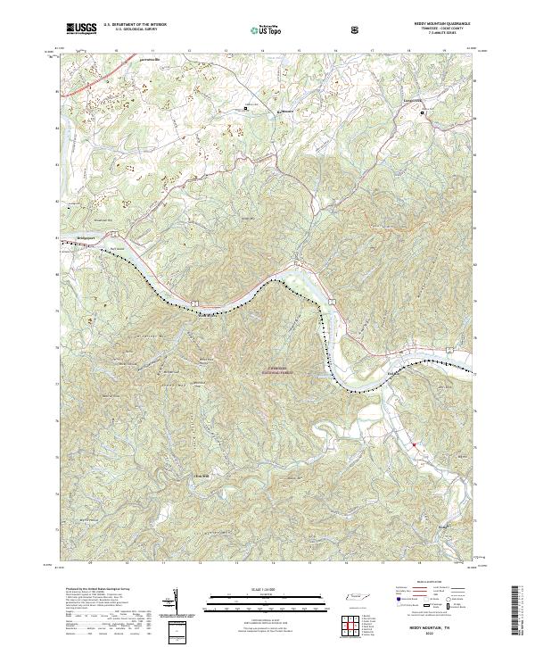
2022 Map of Neddy Mountain
USGS Topo · Published 2022About this map
French Broad River carves a deep valley through the heart of this landscape, separating the high ridges of Neddy Mtn and Yellow Springs Mtn. The terrain is defined by its steep gaps and hollows, including Pigeonroost Gap and Morgan Gap, which historically dictated the flow of travel between the riverside settlements. In the south, the Cherokee National Forest encompasses massive elevations like Sol Messer Mtn and Messer Mtn.
Find a feature on this map
124 named features on this map. Tap any name to fly to it.
Don’t see what you’re looking for? This feature index may not catch every label — zoom into the map to look around manually.
Map Details
Editions of this 2022 Neddy Mountain Map
This is the sole edition of this map. No revisions or reprints were ever made.
Other maps of this area

1883 · Morristown
USGS Topo · 1:125,000

1892 · Greeneville
USGS Topo · 1:125,000

1893 · Mt Guyot
USGS Topo · 1:125,000

1893 · Morristown
USGS Topo · 1:125,000

1894 · Asheville
USGS Topo · 1:125,000

1895 · Morristown
USGS Topo · 1:125,000

1896 · Greeneville
USGS Topo · 1:125,000

1901 · Asheville
USGS Topo · 1:125,000

1904 · Greeneville
USGS Topo · 1:125,000

1912 · Mt Guyot
USGS Topo · 1:125,000