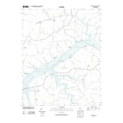
2010 Map of Needmore
USGS Topo · Published 2010About this map
Lake Barkley dominates this 2010 landscape, where the submerged Cumberland River valley creates a wide waterway dotted with landing points and river-bottom features. The settlement of Sailors Rest sits along the southern shore, a historic marker of the area's maritime heritage. Numerous named landings like York Landing, Collier Landing, and Legs Landing punctuate the northern banks, indicating where local commerce and recreational access met the water before and after the formation of the lake.
Find a feature on this map
83 named features on this map. Tap any name to fly to it.
Don’t see what you’re looking for? This feature index may not catch every label — zoom into the map to look around manually.
Map Details
Editions of this 2010 Needmore Map
This is the sole edition of this map. No revisions or reprints were ever made.
Other maps of this area

1931 · Erin
USGS Topo · 1:62,500

1936 · Tantrough Hollow
USGS Topo · 1:24,000

1944 · Clarksville
USGS Topo · 1:50,000

1951 · New Providence
USGS Topo · 1:24,000

1951 · Indian Mound
USGS Topo · 1:24,000

1951 · Woodlawn
USGS Topo · 1:24,000

1956 · Nashville
USGS Topo · 1:250,000

1957 · New Providence
USGS Topo · 1:24,000
1957 · Indian Mound
USGS Topo · 1:24,000
1957 · Woodlawn
USGS Topo · 1:24,000