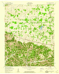
1957 Map of Indian Mound
USGS Topo · Published 1960About this map
Indian Mound serves as the focal point of this Stewart County landscape, situated at the southern edge of the massive Fort Campbell Military Reservation. The map captures a moment of significant topographical change in the late 1950s, explicitly noting that Lake Barkley is currently under construction along the western boundary. This impending inundation contrasts with the established rural character found in the northern half of the sheet, where small communities like Weavers and Legate are connected by narrow roads and family-centered landmarks.
Find a feature on this map
22 named features on this map. Tap any name to fly to it.
Don’t see what you’re looking for? This feature index may not catch every label — zoom into the map to look around manually.
Map Details
Editions of this 1957 Indian Mound Map
4 editions found
Other maps of this area

1931 · Erin
USGS Topo · 1:62,500

1936 · Dover
USGS Topo · 1:24,000

1950 · Dover
USGS Topo · 1:24,000

1951 · Roaring Spring
USGS Topo · 1:24,000

1951 · Johnson Hollow
USGS Topo · 1:24,000

1951 · Indian Mound
USGS Topo · 1:24,000

1951 · Bumpus Mills
USGS Topo · 1:24,000

1951 · Herndon
USGS Topo · 1:24,000

1951 · Woodlawn
USGS Topo · 1:24,000

1956 · Nashville
USGS Topo · 1:250,000