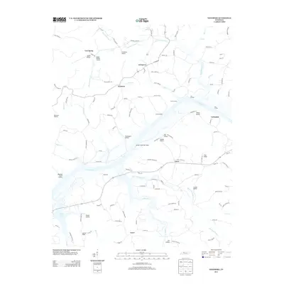
2013 Map of Needmore
USGS Topo · Published 2013About this map
Lake Barkley dominates this part of Tennessee, where the Cumberland River valley is characterized by complex topography and numerous family-named landmarks. The settlement of Needmore sits inland, connected by a network of rural roads such as Sugar Creek Rd and Poplar Springs Rd. Along the shoreline, historical river access points like York Landing, Collier Landing, and Sailors Rest indicate the area's long-standing reliance on water transport. The landscape is deeply incised by countless hollows, including Thomaston Hollow, Isaiah Hollow, and Jarman Hollow, which define the drainage patterns into Yellow Creek and Bear Creek. To the east, the settlement of Corbandale and the heights of Flint Ridge provide further orientation within this varied terrain. Smaller communities like Stringtown and Tarsus are linked to the river economy, while the Yellow Creek Tow Head stands as a prominent feature within the broad expanse of the lake.
Find a feature on this map
119 named features on this map. Tap any name to fly to it.
Don’t see what you’re looking for? This feature index may not catch every label — zoom into the map to look around manually.
Map Details
Editions of this 2013 Needmore Map
This is the sole edition of this map. No revisions or reprints were ever made.
Other maps of this area

1931 · Erin
USGS Topo · 1:62,500

1936 · Tantrough Hollow
USGS Topo · 1:24,000

1944 · Clarksville
USGS Topo · 1:50,000

1951 · New Providence
USGS Topo · 1:24,000

1951 · Indian Mound
USGS Topo · 1:24,000

1951 · Woodlawn
USGS Topo · 1:24,000

1956 · Nashville
USGS Topo · 1:250,000

1957 · New Providence
USGS Topo · 1:24,000
1957 · Indian Mound
USGS Topo · 1:24,000
1957 · Woodlawn
USGS Topo · 1:24,000