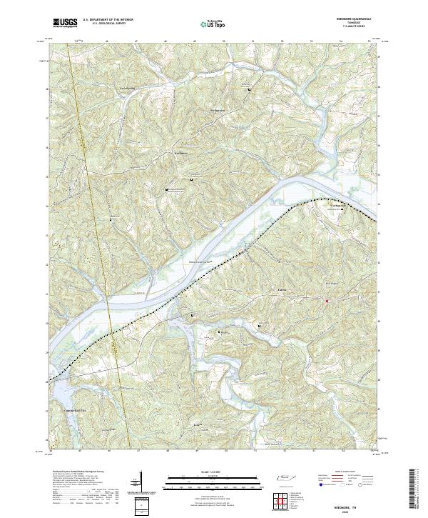
2022 Map of Needmore
USGS Topo · Published 2022About this map
The Cumberland River carves a deep path through the borderlands of Stewart and Montgomery counties, shaping a landscape defined by sharp ridges and narrow hollows. In this part of Tennessee, small settlements like Needmore, Stringtown, and Corbandale occupy the upland plateaus, while the river basin below is marked by the Yellow Creek Tow Head and the mouth of Yellow Creek. The topography is heavily dissected, creating a network of named valleys such as Isaiah Hollow, Poplar Spring Hollow, and Thomaston Hollow that dictated the placement of early roads and homesteads.
Find a feature on this map
118 named features on this map. Tap any name to fly to it.
Don’t see what you’re looking for? This feature index may not catch every label — zoom into the map to look around manually.
Map Details
Editions of this 2022 Needmore Map
This is the sole edition of this map. No revisions or reprints were ever made.
Other maps of this area

1931 · Erin
USGS Topo · 1:62,500

1936 · Tantrough Hollow
USGS Topo · 1:24,000

1944 · Clarksville
USGS Topo · 1:50,000

1951 · New Providence
USGS Topo · 1:24,000

1951 · Indian Mound
USGS Topo · 1:24,000

1951 · Woodlawn
USGS Topo · 1:24,000

1956 · Nashville
USGS Topo · 1:250,000

1957 · New Providence
USGS Topo · 1:24,000
1957 · Indian Mound
USGS Topo · 1:24,000
1957 · Woodlawn
USGS Topo · 1:24,000