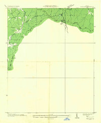
1935 Map of Neels Gap
USGS Topo · Published 1935About this map
Appalachian Trail hikers and local history enthusiasts will find a meticulously documented landscape in this 1935 advance sheet, compiled from aerial photographs by the Tennessee Valley Authority and the Geological Survey. The terrain is defined by the high peaks of the Blue Ridge, including Blood Mtn and Slaughter Mtn. This era shows the early infrastructure of Vogel State Park No 11 and the winding route of Nos 19 and 129 through Neels Gap. Settlements like Natal and landmarks such as Zion Ch are recorded alongside various mountain passes including Jarrard Gap and Woody Gap. The map captures the interface between the Cherokee National Forest and the boundary between Union and Lumpkin counties, providing a detailed record of the ridgelines and watercourses such as Picklesimer Creek and Nottely Falls during the mid-1930s.
Find a feature on this map
36 named features on this map. Tap any name to fly to it.
Don’t see what you’re looking for? This feature index may not catch every label — zoom into the map to look around manually.
Map Details
Editions of this 1935 Neels Gap Map
This is the sole edition of this map. No revisions or reprints were ever made.
Other maps of this area

1886 · Dahlonega
USGS Topo · 1:125,000

1888 · Ellijay
USGS Topo · 1:125,000

1892 · Dahlonega
USGS Topo · 1:125,000

1892 · Ellijay
USGS Topo · 1:125,000

1896 · Dahlonega
USGS Topo · 1:125,000

1898 · Ellijay
USGS Topo · 1:125,000

1903 · Dahlonega
USGS Topo · 1:125,000

1911 · Ellijay
USGS Topo · 1:125,000

1935 · Coosa Bald
USGS Topo · 1:24,000

1935 · Mulky Gap
USGS Topo · 1:24,000