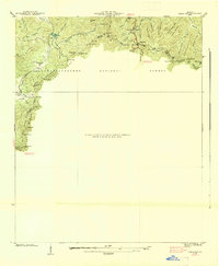
1938 Map of Neels Gap
USGS Topo · Published 1938About this map
Blood Mtn and the crest of the Blue Ridge divide the landscape on this 1938 survey of the Georgia highlands. This map records a critical early period for recreation and conservation in the region, featuring the newly established Vogel State Park and the high-elevation waters of Lake Winfield Scott. The Appalachian Trail follows the ridge line through several notable mountain passes, including Neels Gap, Jarrard Gap, and Slaughter Gap.
Find a feature on this map
63 named features on this map. Tap any name to fly to it.
Don’t see what you’re looking for? This feature index may not catch every label — zoom into the map to look around manually.
Map Details
Editions of this 1938 Neels Gap Map
This is the sole edition of this map. No revisions or reprints were ever made.
Other maps of this area

1886 · Dahlonega
USGS Topo · 1:125,000

1888 · Ellijay
USGS Topo · 1:125,000

1892 · Dahlonega
USGS Topo · 1:125,000

1892 · Ellijay
USGS Topo · 1:125,000

1896 · Dahlonega
USGS Topo · 1:125,000

1898 · Ellijay
USGS Topo · 1:125,000

1903 · Dahlonega
USGS Topo · 1:125,000

1911 · Ellijay
USGS Topo · 1:125,000

1935 · Coosa Bald
USGS Topo · 1:24,000

1935 · Mulky Gap
USGS Topo · 1:24,000