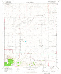
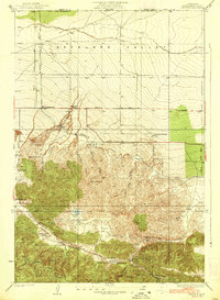
1965 Map of Neenach School
USGS Topo · Published 1966About this map
Neenach School and the surrounding Antelope Valley ranchlands are defined by a meticulous grid of rural roads and water management systems in the mid-1960s. The landscape is a study in agricultural infrastructure, featuring numerous wells, storage bins, and the prominent Los Angeles Aqueduct cutting across the terrain. Local family names are preserved through landmarks like the Gorrindo Ranch and Snyder Ranch, while the small settlement at Antelope Station serves as a focal point for the region. To the south, the terrain shifts abruptly into the foothills of the La Liebre mountains, where Pine Canyon and Happy Valley offer a sharp contrast to the flat valley floor. This survey documents a specific moment in California's high desert development, from the industrial Neenach Substation to a lone mine tucked into the southern ridges.
Find a feature on this map
30 named features on this map. Tap any name to fly to it.
Don’t see what you’re looking for? This feature index may not catch every label — zoom into the map to look around manually.
Map Details
Editions of this 1965 Neenach School Map
3 editions found
Other maps of this area

1903 · Tejon
USGS Topo · 1:125,000

1915 · Elizabeth Lake
USGS Topo · 1:125,000

1917 · Elizabeth Lake
USGS Topo · 1:125,000

1932 · Fairmont
USGS Topo · 1:24,000

1932 · Neenach
USGS Topo · 1:24,000

1933 · Manzana
USGS Topo · 1:24,000
1937 · Fairmont
USGS Topo · 1:24,000
1938 · Manzana
USGS Topo · 1:24,000

1938 · Liebre
USGS Topo · 1:24,000

1943 · Neenach
USGS Topo · 1:62,500