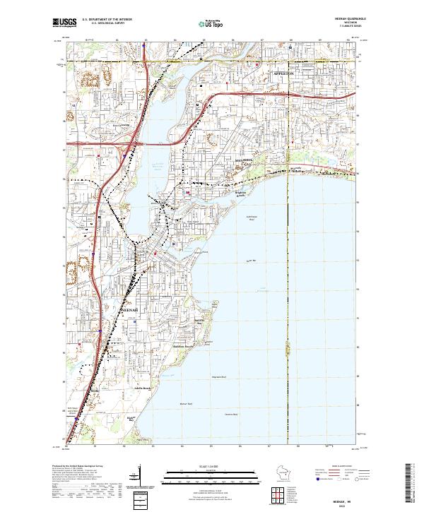
2022 Map of Neenah
USGS Topo · Published 2022About this map
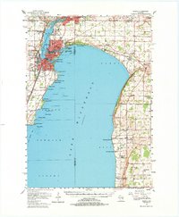
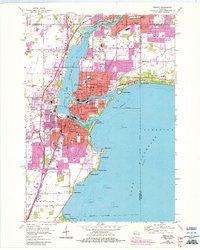
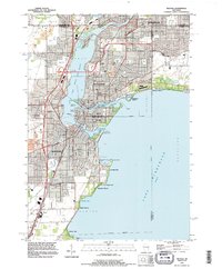
Neenah and Menasha anchor this industrial and residential landscape along the northern shores of Lake Winnebago. The dual-city core is defined by the complex waterways of the Fox River, where it splits around Doty Island into the Neenah Channel and Menasha Channel. These channels historically powered the region's development, leading to the dense urban grids seen here. To the north, Appleton extends into the frame, while the residential expansion of Fox Crossing fills the space between the river and Little Lake Butte Des Morts. Genealogists will find several significant burial grounds, including Saint Margaret's Cem and Saint Marys Cem. The map also captures the local aviation footprint at the With Wings and a Halo Airport and the educational grounds of the University of Wisconsin - Fox Valley. Waterfront features like Rainbow Beach and Sunrise Bay highlight the region's enduring connection to the lake.
Find a feature on this map
60 named features on this map. Tap any name to fly to it.
Don’t see what you’re looking for? This feature index may not catch every label — zoom into the map to look around manually.
Map Details
Editions of this 2022 Neenah Map
This is the sole edition of this map. No revisions or reprints were ever made.
Historical Maps of Harrison Through Time
5 maps found