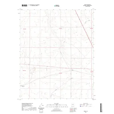
2020 Map of Negra
USGS Topo · Published 2020About this map
Negra sits at a geographic crossroads in Torrance County, centered near a small settlement and the Negra Cem. The high-plains landscape is sparsely populated, characterized by a grid of rural roads and land boundaries such as Big Buck Rd and Negra Trl. To the west, the settlement of Pedernal anchors the edge of the quadrangle, while the northeastern section is defined by a network of local routes including Petez Rd and Perez Rd. This map reflects the vast, open character of central New Mexico, where long stretches of road connect isolated homesteads and cemeteries. The terrain is marked by subtle elevation changes and drainages that reflect the arid environment of the region during this 2020 survey.
Find a feature on this map
19 named features on this map. Tap any name to fly to it.
Don’t see what you’re looking for? This feature index may not catch every label — zoom into the map to look around manually.
Map Details
Editions of this 2020 Negra Map
This is the sole edition of this map. No revisions or reprints were ever made.
Other maps of this area

1954 · Fort Sumner
USGS Topo · 1:250,000

1958 · Fort Sumner
USGS Topo · 1:250,000

1978 · Negra SW
USGS Topo · 1:24,000

1978 · Pedernal Mountain
USGS Topo · 1:24,000

1978 · Pedernal
USGS Topo · 1:24,000

1978 · North Lucy
USGS Topo · 1:24,000

1978 · Santo Nino Canyon
USGS Topo · 1:24,000

1978 · Encino
USGS Topo · 1:24,000

1978 · Negra SE
USGS Topo · 1:24,000

1978 · Negra
USGS Topo · 1:24,000