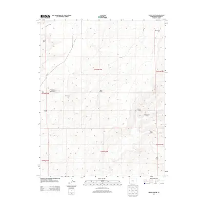
2013 Map of Negro Canyon
USGS Topo · Published 2013About this map
Hovenweep National Monument anchors this 2013 survey of the high desert landscape in Montezuma County. The area is defined by a series of deep drainages cutting through expansive mesas, including Mockingbird Mesa and Cajon Mesa. The map captures the complex topography of the Four Corners region, where several major canyons converge. From the broad McLean Basin in the northwest, the land falls away into Hovenweep Canyon and Negro Canyon, revealing the intricate erosion patterns of the Colorado Plateau. A sparse network of roads, such as Co HWY-10 and Co Road Y, provides the only modern access across these traditional lands. Geographers and historians can trace the relationship between the protected archaeological sites of the monument and the surrounding natural features like Sandstone Canyon and Yellow Jacket Canyon, which have shaped human habitation in this arid corridor for centuries.
Find a feature on this map
22 named features on this map. Tap any name to fly to it.
Don’t see what you’re looking for? This feature index may not catch every label — zoom into the map to look around manually.
Map Details
Editions of this 2013 Negro Canyon Map
This is the sole edition of this map. No revisions or reprints were ever made.
Other maps of this area

1886 · Abajo
USGS Topo · 1:250,000

1892 · Abajo
USGS Topo · 1:250,000

1893 · Abajo
USGS Topo · 1:250,000

1956 · Cortez
USGS Topo · 1:250,000

1957 · Moqui NW
USGS Topo · 1:24,000

1957 · Aneth 1 NE
USGS Topo · 1:24,000

1957 · Cedar 3 SW
USGS Topo · 1:24,000

1957 · Moqui SW
USGS Topo · 1:24,000

1957 · Moqui SE
USGS Topo · 1:24,000

1957 · Monument Canyon
USGS Topo · 1:62,500