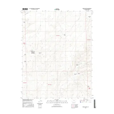
2016 Map of Negro Canyon
USGS Topo · Published 2016About this map
Hovenweep National Monument anchors this 2016 survey of the high desert landscape in Montezuma County. The map details a complex drainage system where Hovenweep Canyon, Bridge Canyon, and Negro Canyon carve through the prominent elevations of Cajon Mesa and Mockingbird Mesa. This territory reflects the characteristic land use patterns of the Four Corners region, where modern county roads like Co Rd Y and Rd 10 follow the straight lines of the Public Land Survey System, often contrasting with the winding natural topography of McLean Basin. In the southeast, the confluence of Yellow Jacket Canyon and Burro Canyon provides a clear view of the deep erosional patterns that have historically defined human settlement and movement across this arid plateau. Researchers will find precise locations for water sources like Cross Canyon Spring amidst a network of canyons including Sandstone Canyon and Risley Canyon.
Find a feature on this map
21 named features on this map. Tap any name to fly to it.
Don’t see what you’re looking for? This feature index may not catch every label — zoom into the map to look around manually.
Map Details
Editions of this 2016 Negro Canyon Map
This is the sole edition of this map. No revisions or reprints were ever made.
Other maps of this area

1886 · Abajo
USGS Topo · 1:250,000

1892 · Abajo
USGS Topo · 1:250,000

1893 · Abajo
USGS Topo · 1:250,000

1956 · Cortez
USGS Topo · 1:250,000

1957 · Moqui NW
USGS Topo · 1:24,000

1957 · Aneth 1 NE
USGS Topo · 1:24,000

1957 · Cedar 3 SW
USGS Topo · 1:24,000

1957 · Moqui SW
USGS Topo · 1:24,000

1957 · Moqui SE
USGS Topo · 1:24,000

1957 · Monument Canyon
USGS Topo · 1:62,500