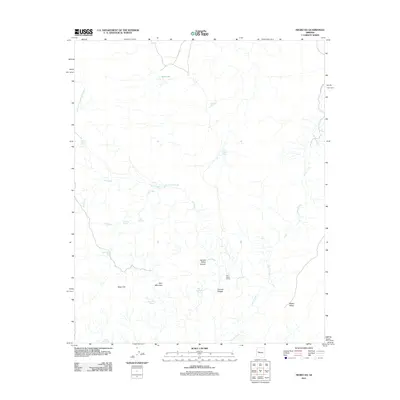
2011 Map of Negro Ed
USGS Topo · Published 2011About this map
Negro Ed and the surrounding high desert of Yavapai County are defined by a complex network of intermittent drainages and critical water sources in an arid landscape. In this 2011 survey, the drainage of Burro Creek dominates the eastern section, while Salt Creek winds through the central terrain, punctuated by named tanks such as Salt Creek Tank and the seasonal Red Lake to the north. These water features, alongside Stone Corral Springs and Pine Flat Spring, suggest the historical importance of the area for ranching and livestock movement, supported by the presence of the Salt Creek Camp. Significant elevation changes are marked by Deer Mountain, Wilder Mesa, and the uniquely named Trot and Holler Canyon, providing a detailed look at the geographic isolation and specialized water management of this Arizona interior.
Find a feature on this map
22 named features on this map. Tap any name to fly to it.
Don’t see what you’re looking for? This feature index may not catch every label — zoom into the map to look around manually.
Map Details
Editions of this 2011 Negro Ed Map
This is the sole edition of this map. No revisions or reprints were ever made.
Other maps of this area

1923 · Signal
USGS Topo · 1:250,000

1942 · Signal
USGS Topo · 1:250,000

1945 · Bagdad
USGS Topo · 1:62,500

1948 · Bagdad
USGS Topo · 1:62,500

1950 · Prescott
USGS Topo · 1:250,000

1954 · Prescott
USGS Topo · 1:250,000

1958 · Prescott
USGS Topo · 1:250,000

1959 · Prescott
USGS Topo · 1:250,000

1960 · Prescott
USGS Topo · 1:250,000

1965 · Prescott
USGS Topo · 1:250,000