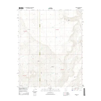
2014 Map of Negro Ed
USGS Topo · Published 2014About this map
Negro Ed lies at the heart of this high-desert landscape along the boundary of Mohave and Yavapai counties. The area is defined by a critical network of water sources essential for survival and livestock in this arid climate, including Stone Corral Springs, Black Willow Spring, and Negro Ed Spring. The terrain transitions from the open flats of the Mojave Desert into prominent geological formations like the Granite Ridges and the isolated heights of Deer Mountain. A series of tanks, such as Deer Mountain Tank and Butte Tank, indicate the management of seasonal runoff. The complex topography is further marked by deep cuts like Pinky Canyon and the evocatively named Trot and Holler Canyon, which drain toward the winding course of Burro Creek. This survey captures the remote character of the Arizona backcountry where ranching infrastructure and natural springs dictate the movement of people and animals.
Find a feature on this map
31 named features on this map. Tap any name to fly to it.
Don’t see what you’re looking for? This feature index may not catch every label — zoom into the map to look around manually.
Map Details
Editions of this 2014 Negro Ed Map
This is the sole edition of this map. No revisions or reprints were ever made.
Other maps of this area

1923 · Signal
USGS Topo · 1:250,000

1942 · Signal
USGS Topo · 1:250,000

1945 · Bagdad
USGS Topo · 1:62,500

1948 · Bagdad
USGS Topo · 1:62,500

1950 · Prescott
USGS Topo · 1:250,000

1954 · Prescott
USGS Topo · 1:250,000

1958 · Prescott
USGS Topo · 1:250,000

1959 · Prescott
USGS Topo · 1:250,000

1960 · Prescott
USGS Topo · 1:250,000

1965 · Prescott
USGS Topo · 1:250,000