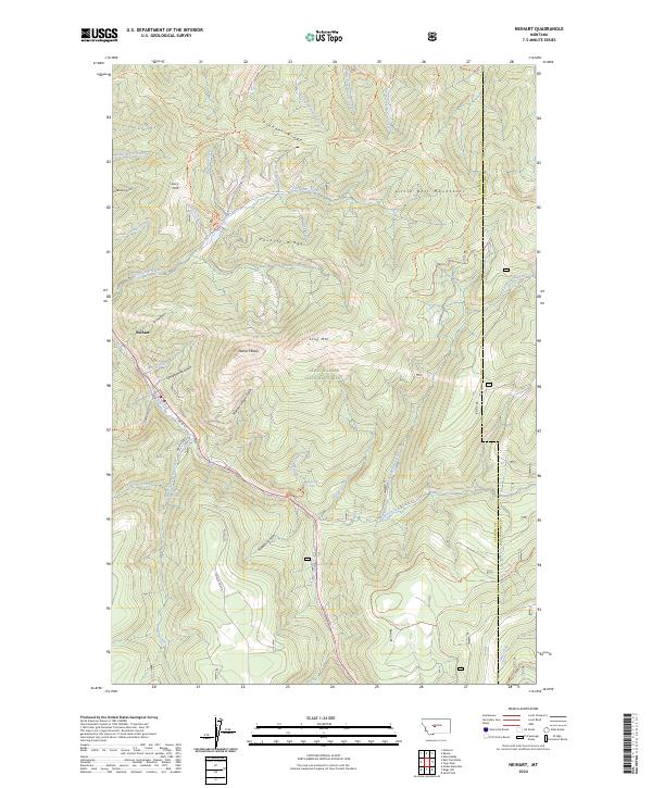
2024 Map of Neihart
USGS Topo · Published 2024About this map
The mountain town of Neihart sits deep within the Lewis & Clark National Forest, centered on the path of Belt Creek as it winds through the Little Belt Mountains. This 2024 survey captures the community's layout along Main St and S Main St, showing a landscape shaped by both its mining history and its current role as an outdoor recreational hub. To the east, the terrain rises sharply toward Neihart Baldy and Long Mtn, while the western slopes are carved by Headstone Gulch and Prospect Creek. The name Narrow Gauge Gulch remains as a persistent linguistic artifact of the era when mountain railroads were essential for extracting ore from these high valleys. To the south, Memorial Falls and the Neihart Reservoir mark the transition toward the high peaks and ridge trails, including the Jefferson Rim Trl and the Pioneer Ridge Trl.
Find a feature on this map
53 named features on this map. Tap any name to fly to it.
Don’t see what you’re looking for? This feature index may not catch every label — zoom into the map to look around manually.
Map Details
Editions of this 2024 Neihart Map
This is the sole edition of this map. No revisions or reprints were ever made.
Other maps of this area

1886 · Little Belt Mts.
USGS Topo · 1:250,000

1890 · Fort Benton
USGS Topo · 1:250,000

1892 · Fort Benton
USGS Topo · 1:250,000

1894 · Little Belt Mts.
USGS Topo · 1:250,000

1897 · Fort Benton
USGS Topo · 1:250,000

1897 · Little Belt Mts.
USGS Topo · 1:250,000

1898 · Little Belt Mts.
USGS Topo · 1:250,000

1902 · Little Belt Mts.
USGS Topo · 1:250,000

1948 · White Sulphur Springs
USGS Topo · 1:250,000

1954 · Great Falls
USGS Topo · 1:250,000