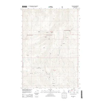
2013 Map of Neil Gulch
USGS Topo · Published 2013About this map
Payette National Forest dominates this high-elevation terrain in Washington County, where the 2013 landscape is defined by its dramatic relief and alpine features. Unusual glacial remnants such as Stickney Glacier and Sheep Camp Glacier sit below ridgelines that separate deep drainages. This high country is a workspace for forest management and recreation, marked by logistical points like the Tool Cache and significant crossings at Benton Saddle and Telephone Saddle. The drainage network is complex, with several branches of Brownlee Creek, including W Brownlee Creek and Middle Brownlee Creek, carving into the plateau. Smaller springs like Arrowhead Spring and Lime Spring provide critical water sources in the dry upland meadows of Pine Grass Flat and Coffee Flat. Near the southern boundary, the Hitt Mountain Ski Area indicates the seasonal recreational utility of these peaks.
Find a feature on this map
34 named features on this map. Tap any name to fly to it.
Don’t see what you’re looking for? This feature index may not catch every label — zoom into the map to look around manually.
Map Details
Editions of this 2013 Neil Gulch Map
This is the sole edition of this map. No revisions or reprints were ever made.
Other maps of this area

1915 · Pine
USGS Topo · 1:125,000

1955 · Baker
USGS Topo · 1:250,000

1957 · Halfway
USGS Topo · 1:62,500

1957 · Copperfield
USGS Topo · 1:62,500

1957 · Sturgill Peak
USGS Topo · 1:62,500

1957 · Mineral
USGS Topo · 1:62,500

1959 · Baker
USGS Topo · 1:250,000

1980 · McCall
USGS Topo · 1:100,000

1981 · Baker
USGS Topo · 1:100,000
1987 · Brownlee Dam
USGS Topo · 1:24,000