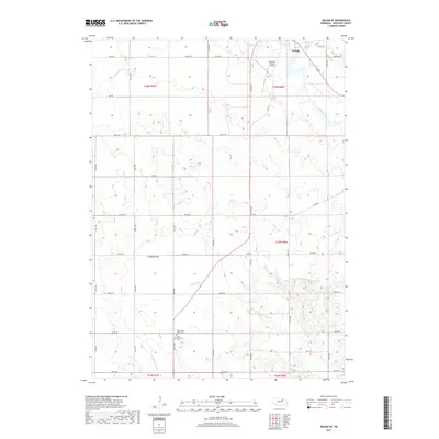
2017 Map of Neligh SE
USGS Topo · Published 2017About this map
The Elkhorn River meanders across the northeast corner of this Antelope County landscape, where the southern reaches of Neligh transition into an expansive agricultural grid. This area is defined by the intersection of several local waterways, including Belmer Cr, Antelope Cr, and Blacksnake Cr, which carve through the plains. The map reveals important community markers such as the Antelope County Airport and a cluster of local heritage sites in the southern sections. Genealogists and local historians will find the adjacent West Cedar Valley Cem and Saint Boniface Cem particularly significant, as they serve as quiet anchors for the rural population. The presence of Flobert Springs Reservoir further illustrates how water management has shaped the land's utility for farming and settlement in this portion of Nebraska.
Find a feature on this map
36 named features on this map. Tap any name to fly to it.
Don’t see what you’re looking for? This feature index may not catch every label — zoom into the map to look around manually.
Map Details
Editions of this 2017 Neligh SE Map
This is the sole edition of this map. No revisions or reprints were ever made.
Other maps of this area

1955 · Broken Bow
USGS Topo · 1:250,000

1955 · Sioux City
USGS Topo · 1:250,000

1955 · Fremont
USGS Topo · 1:250,000

1955 · O'Neill
USGS Topo · 1:250,000

1956 · Broken Bow
USGS Topo · 1:250,000

1957 · Fremont
USGS Topo · 1:250,000

1958 · Sioux City
USGS Topo · 1:250,000

1958 · Fremont
USGS Topo · 1:250,000

1959 · O'Neill
USGS Topo · 1:250,000

1959 · Sioux City
USGS Topo · 1:250,000