
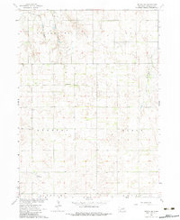
1963 Map of Neligh SW
USGS Topo · Published 1964About this map
Clearwater Creek and its tributaries, Pebble Creek and Snake Creek, carve through this section of Antelope County, revealing a landscape defined by organized rural sections and agricultural development. The map illustrates a mid-century period of land management where township boundaries like Clearwater, Ord, Stanton, and Elgin dictate the placement of local infrastructure. Small pockets of community life are visible through scattered landmarks such as the Townhall and Midland Sch.
Find a feature on this map
16 named features on this map. Tap any name to fly to it.
Don’t see what you’re looking for? This feature index may not catch every label — zoom into the map to look around manually.
Map Details
Editions of this 1963 Neligh SW Map
3 editions found
Other maps of this area

1955 · Broken Bow
USGS Topo · 1:250,000

1955 · O'Neill
USGS Topo · 1:250,000

1956 · Broken Bow
USGS Topo · 1:250,000

1959 · O'Neill
USGS Topo · 1:250,000

1960 · Spalding 2 NE
USGS Topo · 1:24,000

1963 · Neligh
USGS Topo · 1:24,000

1963 · Neligh SE
USGS Topo · 1:24,000

1963 · Deloit
USGS Topo · 1:24,000

1963 · Elgin NW
USGS Topo · 1:24,000

1963 · Deloit NE
USGS Topo · 1:24,000