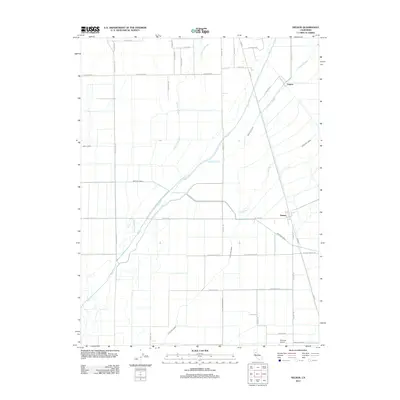
2012 Map of Nelson
USGS Topo · Published 2012About this map
Nelson and Esquon anchor this agricultural landscape in Butte County, where a complex network of irrigation and drainage defines the Central Valley terrain. The presence of the Western Canal and Odell Canal, alongside engineered features like the D-100 Main Drain and Low Lift Lateral, illustrates the intensive water management required for the region's productive grainlands. Natural waterways including Butte Creek, Hamlin Slough, and Durham Slough weave through the rectangular grid of local roads, such as Grainland Road and Nelson Shippee Road. On the southern edge, the Richvale Airport serves the surrounding farming community, while the Midway corridor provides a primary north-south transportation link. This map is a clear record of modern agricultural infrastructure, tracing the paths of both ancient sloughs and the artificial channels that have reshaped the valley floor.
Find a feature on this map
34 named features on this map. Tap any name to fly to it.
Don’t see what you’re looking for? This feature index may not catch every label — zoom into the map to look around manually.
Map Details
Editions of this 2012 Nelson Map
This is the sole edition of this map. No revisions or reprints were ever made.
Other maps of this area

1888 · Marysville
USGS Topo · 1:125,000

1891 · Chico
USGS Topo · 1:125,000

1891 · Marysville
USGS Topo · 1:125,000

1893 · Chico
USGS Topo · 1:125,000

1894 · Marysville
USGS Topo · 1:125,000

1895 · Marysville
USGS Topo · 1:125,000

1895 · Chico
USGS Topo · 1:125,000

1911 · Landlow
USGS Topo · 1:31,680

1912 · Dry Creek
USGS Topo · 1:31,680

1912 · Durham
USGS Topo · 1:31,680