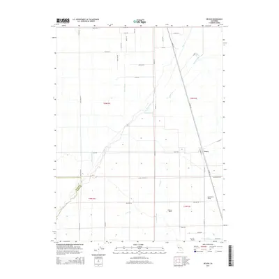
2015 Map of Nelson
USGS Topo · Published 2015About this map
The Sacramento Valley floor dominates this part of Butte County, where a highly organized grid of rural roads and water management systems supports the region's agricultural landscape. The small settlement of Nelson serves as a focal point along the railroad corridor, while Central Valley appears further south near the complex drainage network. Water is the defining feature of the terrain, managed through a series of natural and man-made channels including Butte Creek, Hamlin Slough, and the D D 100 Main Drain. For those tracing local aviation history or land use, the presence of the Richvale Airport and the Low Lift Lateral irrigation feature illustrates the intersection of mid-century infrastructure and industrial farming. The map also captures the precise boundary where the Glenn Co and Butte Co lines meet amidst a landscape of named family roads and throughways.
Find a feature on this map
42 named features on this map. Tap any name to fly to it.
Don’t see what you’re looking for? This feature index may not catch every label — zoom into the map to look around manually.
Map Details
Editions of this 2015 Nelson Map
This is the sole edition of this map. No revisions or reprints were ever made.
Other maps of this area

1888 · Marysville
USGS Topo · 1:125,000

1891 · Chico
USGS Topo · 1:125,000

1891 · Marysville
USGS Topo · 1:125,000

1893 · Chico
USGS Topo · 1:125,000

1894 · Marysville
USGS Topo · 1:125,000

1895 · Marysville
USGS Topo · 1:125,000

1895 · Chico
USGS Topo · 1:125,000

1911 · Landlow
USGS Topo · 1:31,680

1912 · Dry Creek
USGS Topo · 1:31,680

1912 · Durham
USGS Topo · 1:31,680